Sandy Hill
A central neighbourhood next to the University of Ottawa, with a long history and a mostly rental housing stock.
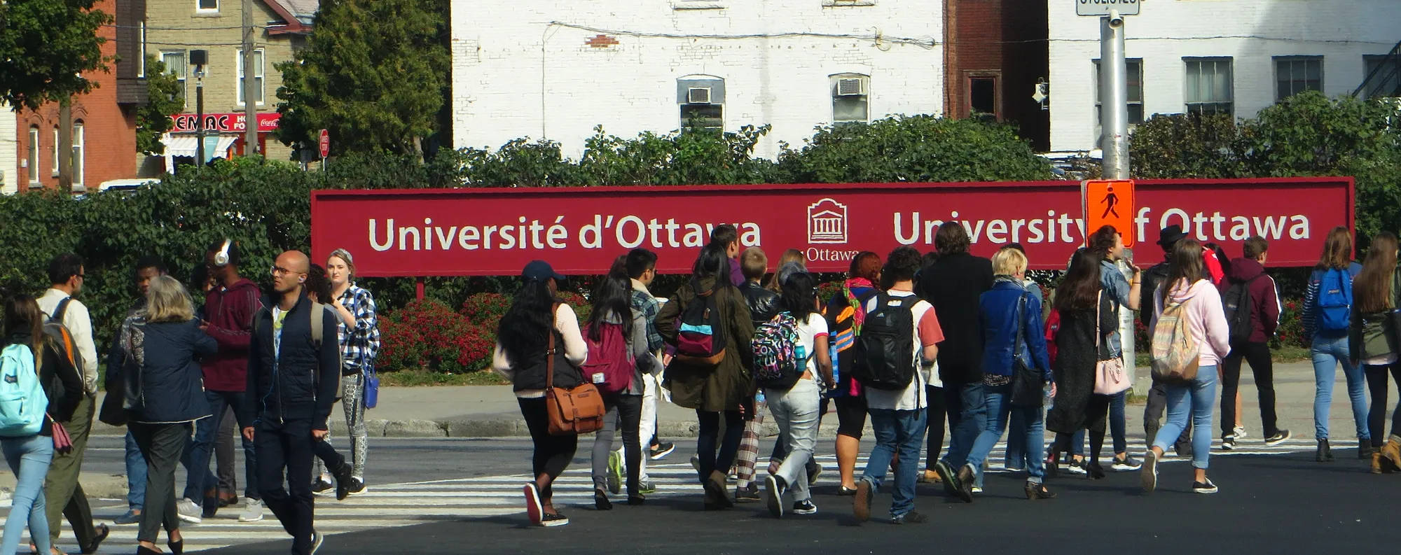
Sandy Hill is a neighbourhood just east of downtown Ottawa, bordered by the Rideau Canal and the Rideau River. Population: 13,840 (2021).
Updated · Facts on this page link to their sources
About Sandy Hill
Sandy Hill is a neighbourhood just east of downtown Ottawa, bordered by the Rideau Canal and the Rideau River. The 2021 census counted 13,840 residents in 9,065 private dwellings, with a median age of 29.8. Most households (75.1%) rented, and apartments make up most of the housing. Historically the home of lumber barons and prime ministers, it now includes embassies, student housing and co-operatives.
Boundaries
Ottawa Neighbourhood Study area "Sandy Hill", described by Wikipedia as running from the Rideau Canal to the Rideau River and from Rideau Street to the Queensway and Nicholas Street. ons-sqo.ca ons-sqo.ca
Homes
In the 2021 census, via the Ottawa Neighbourhood Study, Sandy Hill had 9,065 private dwellings. Apartments in buildings of five or more storeys made up 45.7% and apartments in buildings under five storeys 37.5%, while single-detached houses were 6.3%, row houses 5.7% and semi-detached houses 3.4%. Renter households were 75.1% and owner households 24.9%. ons-sqo.ca
- Population of 13,840 in the 2021 census, with a median age of 29.8
- University of Ottawa station on O-Train Line 1 about 0.6 km away (straight-line)
- About 1.8 km (straight-line) from Parliament Hill
- Ten parks in the City of Ottawa inventory, plus the Sandy Hill Community Centre and Sandy Hill Arena
- French most spoken at home for 17.7% of residents (2021)
- Embassies in former lumber-baron mansions, plus student housing and co-operatives
Community
How Sandy Hill came to be
- 1960s
The neighbourhood was predominantly francophone, and the 1960s Radio-Canada drama "La Côte de Sable" was set there. en.wikipedia.org
Population grew after the Second World War, and many of the grand mansions became embassies. Wikipedia reports that the population dropped by 30% in the 1960s and 1970s. en.wikipedia.org
The Strathcona Heights area in the far south, mostly low-rise subsidised and co-operative apartments, was completely redeveloped in the early 1990s. en.wikipedia.org
The land was originally the estate of Louis-Théodore Besserer, who donated part of it to the University of Ottawa. It was subdivided and became home to most of Ottawa's lumber barons. en.wikipedia.org
During the nineteenth and early twentieth centuries Sandy Hill was Ottawa's wealthiest neighbourhood. After Ottawa became the capital it housed senior public servants and a Prime Minister, who lived at Stadacona Hall and later at what is now Laurier House. en.wikipedia.org
Bridges over the canal, automobiles and streetcars made the area more accessible to downtown. The very wealthy began moving to Rockcliffe Park, and the neighbourhood became denser and more middle class. en.wikipedia.org
Local names worth knowing
- Wilfrid Laurier
Prime Minister, listed on Wikipedia among past residents of Sandy Hill. en.wikipedia.org
- William Lyon Mackenzie King
Prime Minister, listed on Wikipedia among past residents of Sandy Hill. en.wikipedia.org
- Lester B. Pearson
Prime Minister, listed on Wikipedia among past residents of Sandy Hill. en.wikipedia.org
- Elizabeth Smart
Author, listed on Wikipedia among past residents of Sandy Hill. en.wikipedia.org
- Ed Broadbent
NDP Leader, listed on Wikipedia among past residents of Sandy Hill. en.wikipedia.org
- Louis-Théodore Besserer
Original owner of the estate that became Sandy Hill; he donated part of the land to the University of Ottawa. en.wikipedia.org
Around Sandy Hill
Walking rings at 5, 10 and 15 minutes from the neighbourhood centre.
Schools
10 nearbyFrancojeunesse Public Elementary School
CÉPEO119 rue Osgoode Stmaps.ottawa.ca cepeo.on.ca
250 m3 min walkViscount Alexander Public School
OCDSB55 av. Mann Avemaps.ottawa.ca ocdsb.ca
490 m6 min walkLisgar Collegiate Institute
OCDSB29 rue Lisgar Stmaps.ottawa.ca ocdsb.ca
910 m11 min walkSainte-Anne Catholic Elementary School
CECCE235 prom. Beausoleil Drmaps.ottawa.ca ecolecatholique.ca
940 m12 min walkYork Street Public School
OCDSB310 rue York Stmaps.ottawa.ca ocdsb.ca
960 m12 min walkPublic Elementary School Mauril Bélanger
CÉPEO307 rue Montgomery Stmaps.ottawa.ca cepeo.on.ca
1.2 km15 min walkDe la Salle Public High School
CÉPEO501 rue Old St-Patrick Stmaps.ottawa.ca cepeo.on.ca
1.3 km16 min walkElgin Street Public School
OCDSB310 rue Elgin Stmaps.ottawa.ca ocdsb.ca
1.3 km16 min walkContinuing Education
CECCE181 rue Donald Stmaps.ottawa.ca ecolecatholique.ca
1.3 km17 min walkLady Evelyn Alternative School
OCDSB63 av. Evelyn Avemaps.ottawa.ca ocdsb.ca
1.4 km17 min walk
Straight-line distances from the Sandy Hill centre. Living near a school does not guarantee a place: confirm the designated school for an address with each board. All schools and board locators.
Parks & places
10 nearbySandy Hill Community Centre
Community Centre
250 Somerset St Eastmaps.ottawa.ca ottawa.ca
180 m2 min walkAnnie Pootoogook Park
Active Recreation park
250 Somerset Street, Ottawamaps.ottawa.ca
230 m3 min walkOutdoor rink, Sandy Hill Park and Community Centre
Outdoor rink (winter, weather permitting)
250 Somerset St. E.maps.ottawa.ca ottawa.ca
250 m3 min walkSt. Germain Park
Active Recreation park
86 A Templeton Street, Ottawamaps.ottawa.ca
380 m5 min walkCindy Mitchell Park
Active Recreation park
288 Chapel Street, Ottawamaps.ottawa.ca
390 m5 min walkSplash pad, Cindy Mitchell Park
Splash pad (summer only)
288 Chapel Street, Ottawamaps.ottawa.ca ottawa.ca
390 m5 min walkStrathcona Park
Active Recreation park · waterfront access
25 Range Road, Ottawamaps.ottawa.ca
520 m7 min walkSandy Hill Arena
Arena
60 Mann Avemaps.ottawa.ca ottawa.ca
580 m7 min walkSandy Hill Arena
Active Recreation park
60 Mann Avenue, Ottawamaps.ottawa.ca
610 m8 min walkOttawa Public Library Rideau Branch
Public Library
377 Rideau Stmaps.ottawa.ca biblioottawalibrary.ca
790 m10 min walk
Shops & dining
10 nearbyCampus Pharmacy
Pharmacy
100 Marie-Curie Privateopenstreetmap.org
360 m5 min walkI.D.A.
Pharmacy
390 Rideau Streetopenstreetmap.org
740 m9 min walkShoppers Drug Mart
Pharmacy
322 Rideau Streetopenstreetmap.org
760 m10 min walkPharmasave
Pharmacy
423 Rideau Streetopenstreetmap.org
780 m10 min walkPharmasave
Pharmacy
306 Rideau Streetopenstreetmap.org
780 m10 min walkLoblaws
Supermarket
363 Rideau Streetopenstreetmap.org
820 m10 min walkLoblaw Pharmacy
Pharmacy
375 Rideau Streetopenstreetmap.org
850 m11 min walkRemedy'sRx
Pharmacy
545 Rideau Streetopenstreetmap.org
890 m11 min walkMetro
Supermarket
255 Rideau Streetopenstreetmap.org
890 m11 min walkSt. Mary Pharmacy & Family Clinic
Pharmacy
158 Rideau Streetopenstreetmap.org
1.0 km13 min walk
Getting around
TransitCampus station
Transitway / transit station (City of Ottawa transit stations layer)
openmaps.ottawa.ca
560 m7 min walkuOttawa station
O-Train Line 1
openwikidata.org en.wikipedia.org
580 m7 min walkLaurier South station
Transitway / transit station (City of Ottawa transit stations layer)
openmaps.ottawa.ca
730 m9 min walkLaurier North station
Transitway / transit station (City of Ottawa transit stations layer)
openmaps.ottawa.ca
730 m9 min walkO-Train
uOttawa station is about 0.6 km away in a straight line (open; Line 1).
O-Train
Lees station is about 1.0 km away in a straight line (open; Line 1).
Transitway / bus
Campus station is about 0.6 km away in a straight line (open).
Downtown
Parliament Hill is about 1.8 km away in a straight line.
For sale in Sandy Hill
No Sandy Hill homes on sandyhill.homes right now
Selling here? Get a website for your home, or browse every home for sale in the area.
Neighbouring areas
Quick answers
Short answers first; each links to the full answer and its sources.
Is Sandy Hill a good place to live?
That depends on what you want from a home. Sandy Hill is a central Ottawa neighbourhood about 1.8 km (straight-line) from Parliament Hill, with an O-Train station about 0.6 km away, 10 parks and a mostly apartment-based housing stock. In the 2021 census, 75.1% of households rented and the median age was 29.8.
As of 2026-10 · ons-sqo.ca en.wikipedia.org
Where is Sandy Hill in Ottawa?
Sandy Hill is a neighbourhood just east of downtown Ottawa. It is bordered on the west by the Rideau Canal and on the east by the Rideau River, according to Wikipedia. Its French name is Côte-de-Sable.
As of 2026-10 · en.wikipedia.org
How far is Sandy Hill from downtown Ottawa?
Sandy Hill's centre is about 1.8 km from Parliament Hill, measured in a straight line. Wikipedia describes the neighbourhood as located just east of downtown.
As of 2026-10 · en.wikipedia.org en.wikipedia.org
What schools serve Sandy Hill?
Nearby schools include Viscount Alexander Public School (OCDSB, about 0.5 km), Francojeunesse Public Elementary School (CÉPEO, about 0.3 km) and Sainte-Anne Catholic Elementary School (CECCE, about 0.9 km), all straight-line. Which school serves a given address depends on the board's catchment, so families must confirm with each board's school locator.
As of 2026-10 · maps.ottawa.ca maps.ottawa.ca
Are there French-language schools in Sandy Hill?
Yes. Francojeunesse Public Elementary School (CÉPEO) is about 0.3 km from Sandy Hill's centre in a straight line, and Sainte-Anne Catholic Elementary School (CECCE) is about 0.9 km. Public Elementary School Mauril Bélanger (CÉPEO) is about 1.2 km away, and De la Salle Public High School (CÉPEO) about 1.3 km.
As of 2026-10 · maps.ottawa.ca maps.ottawa.ca
Which high schools are near Sandy Hill?
The nearest secondary school to Sandy Hill is Lisgar Collegiate Institute (OCDSB), about 0.9 km away in a straight line. De la Salle Public High School (CÉPEO, French) is about 1.3 km away, and Immaculata High School (OCSB) is about 1.4 km from the neighbourhood centre.
As of 2026-10 · maps.ottawa.ca maps.ottawa.ca